Loading...
Showing posts with label Island. Show all posts

Karimunjawa Island, The Paradise of Java Indonesia

03:21 Add Comment
Karimunjawa Island, The Paradise of Java Indonesia

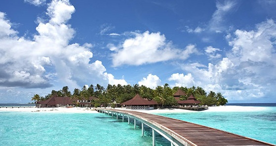
Karimunjawa is an archipelago in the Java Sea that belongs to Jepara regency, Central Java. With a land area of ??± 1,500 hectares and a water ± 110,000 hectares, Karimunjawa is now developed into a charm of Marine Park tourism that began to favor a lot of local and foreign tourists.

Based on the legend circulating in the archipelago, Karimunjawa Island was discovered by Sunan Muria. The legend revolves around Sunan Muria who is concerned over the mischief of his son, Amir Hasan. With the intention of educating, Sunan Muria then ordered his son to go to an island that appears "kremun-kremun" (escape) from the top of Mount Muria so that the child can deepen and develop his religious knowledge. Because it looks "kremun-kremun" then called the island is Karimun Island.

Ecosystems

Since March 15, 2001, Karimunjawa was established by the government of Jepara as a National Park. Karimunjawa is home to coral reefs, mangrove forests, coastal forests, and nearly 400 species of marine fauna, of which 242 species of ornamental fish. Some of the rare fauna that habits here are the White Sea Chest Elang, hawksbill, and green turtles.

The plants that characterize the Karimunjawa National Park are dewadaru (Crystocalyx macrophyla) found in lowland rain forest.

The waves in Karimunjawa are low and benign, bounded by beaches, mostly white sand beaches.

Geographical

Karimunjawa is located in the Java Sea, north of Jepara, Central Java. The archipelago consists of 27 islands:

    Occupants:
        Karimunjawa
        Rain
        Mosquito
        Parang
        Genting
    Uninhabited:
        Big Menjangan
        Menjangan Kecil
        Big Firs
        Small Firs
        Geleyang (30 ha)
        Bird
        Bengkoang (92 ha)
        Twins (11.2 ha)
        Katang (2.8 ha)
        Large Krakal (2.8 ha)
        Small Krakal (2.8 ha)
        Sintok
        Mrican
        Central
        Edge
        Little (2 ha) [1]
        Bare
        Seruni
        Mining
        Scholar
        Beetle (8.8 ha)
        Saw (or Island Menyawakan).

Population

Karimunjawa has more than 10,100,000 inhabitants in five uninhabited islands. The three main tribes inhabiting Karimunjawa are the Javanese who farm and produce household utensils, Bugis who are reliable sailors who work as fishermen, and the Madurese who also work as fishermen but have the advantage of making dried fish.

Education in Karimunjawa has reached up to high school level. In addition to having about 10 elementary schools (five in Karimun, three in Kemujan and one each in Parang and Genting), Karimunjawa also has one junior high school, Madrasah Tsanawiyah (MTs), and SMK Negeri majoring Seaweed Cultivation and Fishery Products Processing Technology free school, and one Madrasah Aliyah in Penghujan.

Transportation

The most commonly used transportation to Karimunjawa is the ship from Semarang and Jepara. From the Port of Tanjung Emas, Semarang, the Kartini I (fast boat) boat departs every Saturday at 9 am to Karimunjawa and returns from Karimunjawa every Sunday noon, a 2-3 hour crossing.

From the Port of Kartini Beach, Jepara is a Muria Ship that departs every two days, the length of this economic ship crossing +/- 6 hours of voyage. please note to schedule ship from port Jepara usually departing Tuesday, Thursday, Saturday at 9 am and from karimunjawa to jepara Wednesday, Friday, Sunday at 8 am. this schedule can change according to the weather or the waves in the Java sea. in case of high waves, the port authorities will not grant a shipping permit, and the ship's departure schedule will change following the weather change. Jepara Port can also bring Cars and motorcycles to be crossed to Karimunjawa.

Air line can be reached from Ahmad Yani Airport, Semarang to Dewa Daru Airport on Kemujan Island with CASA 212 type charter plane provided by PT. Nusa Permai Sea Tour (Turtle Resort). Travel time is approximately 30 minutes.

Tourism

Kecamatan Karimunjawa has many tourist attractions, including:

Natural tourism

Kecamatan Karimunjawa has several natural attractions, namely:

    Swimming Sharks, in the Village of Karimunjawa (Menjangan Besar Island)
    Legon Lele, in Karimunjawa Village (Karimunjawa Island)
    Love Hill, in Karimunjawa Village Dusun Jatikerep (Karimunjawa Island)
    Bukit Nyamplungan, in Karimunjawa Village (Karimunjawa Island)
    Bukit Joko Tuo, in Karimunjawa Village (Karimunjawa Island)
    Tracking Mangrove Forest, in Kemojan Village (Kemujan Island)
    Pantai Karang Pengantin, in Kemojan Village Karanglawang Dukuh (Kemujan Island)
    Pantai Ujung Gelam, in Karimunjawa Village (Karimunjawa Island)
    Batu Mask Beach, in Karimunjawa Village (Karimunjawa Island)
    Barakuda Beach, in Kemojan Village (Kemujan Island)
    Nirwana Beach, in Karimunjawa Village (Karimunjawa Island)

Culinary tour

Kecamatan Karimunjawa has several culinary attractions, namely:

    Karimunjava Culinary Center, in Karimunjawa Village (Near Karimunjawa Square)

Religious tourism

Kecamatan Karimunjawa has several religious attractions, namely:

    Tomb of Sunan Nyamplungan, in Karimunjawa Village (Karimunjawa Island)
    Tomb of Sayid Kambang, in Karimunjawa Village (Karimunjawa Island)
    Tomb of Sayid Abdullah, in Karimunjawa Village (Karimunjawa Island)

Typical Culinary Karimunjawa

Cook
The typical cuisine of Karimunjawa, is:

    Pindang Serani
    Meatball Yellow Tailed Fish
    Lontong Krubyuk
    Tongseng Cumi
    Siomay Tongkol

Drinks
The typical drink of Karimunjawa, is:

    Wedang Blung
    a hot ginger drink
    Ice Coconut Rainbow

Snacks
The typical snacks of Karimunjawa are:

    Klepon Alang-Alang
    Jenang Krimun
    Roasted bananas

Souvenirs
The typical souvenirs of Karimunjawa are:

    Gereh Iwak Teri

Nickname
Karimunjawa Islands have several nicknames, including:

 Karimunjawa, Holiday Island


Karimunjawa is perfect in the holiday, after many months busy by work, so Karimunjawa can refresh the mind. In Karimunjawa as if vacation all the time, due to its exquisite and exotic nature.

Karimunjava, The Paradise of Java


Karimunjawa there are nature that is still green, natural and beautiful. The Nature that makes tourists feel at home in Karimunjawa because of the friendly atmosphere of the community, the air is still clean, like paradise Java Island because it is still included in the administration of Java.

Karimunjava, Caribbean van Java


The beauty of Karimunjawa Islands is as beautiful as in the Caribbean. Karimunjawa has another similarity with the Caribbean that is composed of several small islands, therefore the Netherlands gave the nickname as Caribbean van Java.

Planning
Plans that can increase tourists visiting, are:

    Build a Karimunjava Zoo like Bali Zoo
    Build a Village with Custom House Typical Jepara as in Mareokoco Semarang or House residents are recommended in the form of traditional house typical Jepara with Wuwuhan Genteng and Home House residents must have a temple fence Bentar like in Mantingan
    Build Karimunjawa Square to be neat and clean and not chaotic by street vendors, by building culinary center near Karimunjawa Alun-Alun
    Take off the wicket in Karimunjawa Square, build a mini stadium and move the crossbar to the mini stadium, so Karimunjawa Square is only for Ceremony, Event, and public facilities.
    Residents are advised to use traditional Javanese clothes every day
    Buy a submarine like in Bali for tourists who want to see Karimunjawa coral reef but can not dive
    Building underwater power cables that can run from Jepara to Karimunjawa for 24 hours and fiber optic cable for internet access in Karimunjawa


Important Phone Karimunjawa

Emergency and important numbers in Kecamatan Karimunjawa, namely:

    Polsek karimunjawa = (0297) 312210
    Port of Karimunjawa = (0297) 312121
    Puskesmas Karimunjawa = (0297) 312137

Natuna Island, a Natural Island that Holds Great Natural Wealth

14:42 Add Comment
Natuna Island, a Natural Island that Holds Great Natural Wealth

Natuna regency, is one of the regencies in Riau Islands Province, Indonesia. Natuna is the northernmost archipelago in the Karimata strait. To the north, Natuna is bordered by Vietnam and Cambodia, in the south by South Sumatra and Jambi, in the west by Singapore, Malaysia, Riau and the east with East Malaysia and West Kalimantan. Natuna is on international shipping lines Hongkong, Japan, South Korea and Taiwan. The regency is famous for producing oil and gas. Natuna's petroleum reserves are estimated at 1. 400.386.470 barrels, while natural gas is 112,356,680,000. barrel. Natuna's distinctive animals are a must.

History

History of Natuna Regency can not be separated from the history of Riau Islands Regency, because before standing alone as an autonomous region, Natuna Regency is part and Region of Riau Islands. Natuna Regency was established based on Law no. 53 of 1999 which was ratified on 12 October 1999, with the inauguration of Natuna Regent Drs. H. Andi Rivai Siregar by the Minister of Internal Affairs ad interm General TNI Faisal Tanjung in Jakarta.

Based on the Decree of the Delegation of the Republic of Indonesia, Central Sumatera Province dated May 18, 1956, incorporated into the Territory of the Republic of Indonesia and the Riau Islands were granted the status of the Second Level Autonomous Region headed by the Regent as the head of the region which oversees 4 consent as follows:

Kewedanaan Tanjungpinang, covering the District of South Bintan (including East Bintan, Galang, Tanjungpinang Barat and Tanjungpinang Timur).
Karimun Kewedanaan, covering the District of Karimun, Kundur and Moro.
Kewedanaan Linga, covering the District of Lingga, Singkep and Senayang.
Kewedanaan Pulau Tujuh, covering the District of Jemaja, Siantan, Midai, Serasan, Tembelan, Bunguran Barat and Bunguran Timur.

Kewedanaan Pulau Tujuh that oversees the District of Jemaja, Siantan, Midai, Serasan, Tambelan, West Bunguran and East Bunguran along with kewedanaan laiannya deleted by Decree of the Governor of Riau Province on 9 August 1964. UP / 247/5/1965. Based on the decree, effective January 1, 1966 all administrative regions of kewedanaan in Kepulauan Riau Regency are deleted.

Natuna Regency was established based on Law no. 53 of 1999 from the expansion of the Regency of Riau Islands consisting of 6 Subdistricts of East Bunguran District, West Bunguran, Jemaja, Siantan, Midai and Serasan and one District Assistant Tebang Ladan.

Along with the authority of regional autonomy, Natuna Regency then expanded the sub-districts up to 2004 into 10 sub-districts with the addition of Kecamatan Pal Matak, Subi, Bunguran Utara and Pulau Laut with 53 villages / villages.

Until 2007 Natuna Regency has 16 subdistricts. 6 new division districts include Pulau Tiga District, Northeast Bunguran, Central Bunguran, South Siantan, East Siantan and East Jemaja with total number of kelurahan / village as many as 75.

In the year 2008 Natuna regency did expansion with formed Anambas Islands District, so the district become 12 District. Then until 2015 to 70 Villages and 6 Villages. And there will be 3 Subdistricts of Sebinggan become 16 Subdistricts.

Topography

Based on his physical condition, Natuna Regency is a hilly and rocky terrain. Lowland and ramps are found on the beach. The altitude of the area between districts is quite diverse, ranging from 3 to 959 meters from sea level with a slope of between 2 to 5 meters. In general, the soil structure consists of red yellow podzolic soil from rocks whose soils essentially have granite material, and alluvial and soil organosol and gley humus.

Climate and Weather

The climate in Natuna Regency is wet tropical with an average temperature of 26 ° C and is strongly influenced by changes in wind direction. Its humidity ranges between 60% and 85%. Meanwhile, rainfall average of 2530 mm with the number of rainy days 110 per year. The wet months occur in October-December with an average wind speed of 276 km per day [sic]. Meanwhile, the sun's irradiation averaged 53%. The weather is often erratic. The rain accompanied by strong winds, thunderous storms, and waves that reached a height of more than three meters often occur suddenly.
Based on the wind direction, local people recognize the existence of 4 seasons, namely: North, East, South, and West. The North season is characterized by winds blowing from the east. This season runs for 4 months (November-February). In this season the wind blows very fast (speed reaches 15-30 knots), so the sea surges through the day and night with a height of 1--3 meters. The local community described the sea as full of waves as "the face of the rotting lime". The wind that blows this season seems not only to make the sea malignant, but also destroys the trees. The trunk of a coconut tree is leaning towards the south. Then, the leaves become split. Instead, the leaves of the rubber trees are falling, so it seems to be arid. This frightening season by them is also called "Season of the unmarked bed nets", because the season is accompanied by rain throughout the day and night, so they prefer to lie down with the bed nets unveiled next door. Therefore, Ibrahim (1997) said that in the north season Natuna residents really have difficulty to do their work. For that, in advance they have prepared everything to face it, such as: firewood, rice, side dishes (salted fish), and other kitchen purposes.

The eastern season is characterized by winds blowing from the east. This season also runs for 4 months (March-June). The average wind speed is only 12 knots. Heavy rains are rare. Sometimes rain is accompanied by heat. The sun is slightly free to shine on the sea and land, so the heat is quite stinging. Such heat, by the local community is called ngek-ngek or lak-lak (it seems uncertain). Nevertheless, the sea still looks bumpy so it is rather difficult to get fish.

The South season is marked by a wind that blows from the south. The season that lasted for 2 months (July-August) this wind speed average of 8--20 knots. In this season the sun can shine freely so the heat is very stinging. Such a situation by the local people is described as "the vapor of hell". Sea conditions are still wavy, sometimes even can reach more than 3 meters.

The West season is characterized by winds that blow from the west also lasts for 2 months (September-October). The hallmark of this season is between the heat and the rain changing. Therefore, the sea surface is sometimes like "water in a talam" (calm and calm), but sometimes it is frightening because its waves can reach 3 meters more. Unfortunately, these waves often occur suddenly so as not to provide opportunities for the fishermen to pull over the boat.

Demographics

Population

The population of Natuna Regency in 2010 amounted to 69,003 people, consisting of 35,741 male and 33,262 female. Serasan sub-district is the highest density of 124.10 people per km2, followed by Midai 123.97 people per km2.

Religion

Based on the Population Census in 2015, the percentage of religion in Natuna Regency is Islam 96.47%, Protestant Christians 1.56%, Buddhism 1.38%, Catholic 0.43%, Confucian 0.12% and Hindu 0.02%.

Potential

In addition to its strategic location of Natuna Island and its surrounding areas is essentially blessed with a series of potential natural resources that have not been adequately managed or there is not yet at all, namely:

    Marine fishery resources reaching more than 1 million tons per year with total utilization of only 36%, which is only about 4.3% by Natuna Regency.
    Agriculture & plantations such as yams, coconuts, rubber, palm and cloves.
    Attractions: nautical (beaches, diving islands), mountains, waterfalls, caves and cultivation.
    The D-Alpha gas field located 225 km to the north of Natuna Island (in ZEEI) with a total reserve of 222 trillion cubic feet (TCT) and 46 TCT hydrocarbon gas is one of Asia's largest sources.

Nias Island, a Beautiful Island Located on the Western Island of Sumatra Indonesia

13:51 Add Comment
Nias Indonesia


Nias (Nias language Tanö Niha) is an archipelago located on the western part of the island of Sumatra, Indonesia, and administratively located within the province of North Sumatra. This island is the largest and most developed island among jejeran islands on the west coast of Sumatra, inhabited by the majority of Nias tribes (Ono Niha) who still have a megalithic culture. The area has important tourist attractions like surfing (surfing), traditional house, diving, fahombo (stone jumping).

The island with an area of 5,625 km ² is populated nearly 900,000 inhabitants.

The majority religion in this area is Protestant Christians where 90% of the population embraces this religion, while the rest are Catholic, Muslim, and Buddhist. People who convert to Islam are generally located in coastal areas of the Nias Islands.

The former island of Nias is only one district, now divided into four districts and one city, namely Nias District, South Nias Regency, West Nias Regency, North Nias Regency, and Gunungsitoli Municipality.

Tsunami & Earthquake 2004 and 2005

On December 26, 2004, the 2004 Indian Ocean earthquake occurred on the west coast of the island resulting in a 10 meter high tsunami in Sirombu and Mandrehe areas. The death toll from the incident amounted to 122 people and hundreds of families lost their homes.

On March 28, 2005, the island was again rocked by an earthquake, believed to be aftershocks after the December 2004 incident, but now it is the second strongest earthquake in the world since 1965. At least 638 people were reported killed and hundreds of buildings destroyed.

Almost no public housing buildings in Nias Island were not damaged, due to the earthquake.

According to the Rehabilitation and Reconstruction Agency (BRR) of Nias Representative, the disaster has caused 13,000 houses totally destroyed, 24,000 houses were severely damaged, and about 34,000 houses were slightly damaged. A total of 12 ports and docks were destroyed, 403 bridges were damaged and 800 km of district roads and 266 km of provincial roads were destroyed. A total of 723 schools and 1,938 places of worship were damaged.


Tribe of Nias

The Nias are a group of people living on the island of Nias. In the original language, Nias people call themselves "Ono Niha" (Ono = son / descendant; Niha = human) and Nias island as "Tanö Niha" (Tanö = land).

The tribe of Nias is a society that lives in high culture and customs. The customary law of Nias is generally called fondrakö which regulates all aspects of life from birth to death. The ancient Nias people live in a megalithic culture evidenced by historical relics of carvings on large boulders still found in the inland areas of this island to the present day. Caste: The tribe of Nias recognizes the caste system (12 levels of Caste). Where the highest caste level is "Balugu". To reach this level one must be able to make large parties by inviting thousands of people and slaughtering thousands of pigs for days.

The origin of the Nias people

Mythology

According to the people of Nias, one of the myths of the origin of the Nias tribe comes from a tree of life called "Sigaru Tora`a" located in a place called "Tetehöli Ana'a". According to the above-mentioned myth the first human arrival to Nias Island began in the time of King Sirao who had 9 sons who were ordered to leave Tetehöli Ana'a for the Throne of Sirao. The 9 sons were considered the first people to set foot on Nias Island.

Archaeological Research

Archaeological research has been conducted on Nias Island since 1999. This study found that there have been humans on Nias Island since 12,000 years ago who migrated from the Asian mainland to Nias Island during the paleolithic period, and even indicated since 30,000 years ago Prof. said. Harry Truman Simanjuntak from the National Archaeological Research and LIPI Jakarta. At that time only Hoabinh culture, Vietnam is the same as the existing culture in Nias Island, so it is suspected that the origin of the Nias tribe originated from the Asian mainland in an area that is now a country called Vietnam.

Recent genetic research has found that the people of Nias, North Sumatra, come from the Austronesian family. Nias ancestors were thought to have come from Taiwan through the Philippines path 4,000-5,000 years ago.

Mannis van Oven, doctoral student from the Department of Forensic Molecular Biology, Erasmus MC-University Medical Center Rotterdam, presented his findings at the Eijkman Institute of Molecular Biology, Jakarta, Monday (4/15/2013). In a study that has lasted for about 10 years. Ovens and team members examined 440 blood samples of residents in 11 villages on Nias Island.

"Of all the populations we studied, Y-chromosomes and mitochondria-DNA of the people of Nias are very similar to those of Taiwan and the Philippines," he said.

The Y chromosome is the male carrier. Male man has XY chromosome, while female XX. Mitochondrial-DNA (mtDNA) is inherited from the mother's chromosome.

The study also found that in the current Nias genetics there is no trace of the ancient Nias people whose remains are found in Goa Togi Ndrawa, Central Nias. Archaeological research on stone tools found shows, the humans who occupy the cave comes from the period 12,000 years ago.

"The genetic diversity of the people of Nias is very low compared to other populations, especially from the Y-chromosome, indicating that there has been a bottleneck of population in Nias's past history," he said.

The study also found that the people of Nias do not have genetic links with people in the geographically neighboring Andaman-Nicobar Islands in the Indian Ocean.

Traces are disconnected


Responding to the findings, archaeologists from the National Archaeological Research Center Sony Wibisono said the theory about the origin of the archipelago from Taiwan has long been delivered, for example by Peter Bellwood (2000). Bellwood's theory is based on the similarity of earthenware forms.

"The problem is whether the migration is in the same direction from Taiwan to the archipelago, including to Nias, or vice versa also happens?" he said. Sony questioned how the Austronesian migration from Taiwan to Nias took place.

Herawati Sudoyo, Deputy Director of Eijkman Institute who is also a speaker, said the Austronesian migration to the archipelago remains a puzzle. "Logically, from their Philippines to Kalimantan and Sulawesi. However, until now genetic data from Kalimantan and Sulawesi is still minimal. There is still a missing link, "he said.

In Kalimantan, according to Hera, the new genetics of Banjar are examined. The result shows that they are Malay people. In Sulawesi studied only in South Sulawesi. "There are still many studies to be done," he said.

The clan of Nias

The Nias people apply the clan system following the patrilineal line. The clans generally come from existing settlement villages.

Access to Nias

Transportation to Nias Island

The journey to Nias Island from Medan City (capital of North Sumatera province) can be reached through two transportation lines namely land and sea transportation. When choosing a land-sea journey then travel from Medan to Sibolga Port can be reached for approximately 10-12 hours using land transportation such as private cars, public buses, or travel car. At this port, the journey to Nias Island can use the Ferry which sails daily to and from Nias Island. This sea trip can be reached during the 12 hour journey. When choosing air travel, the flight from Medan to Gunungsitoli can be reached from Kualanamu International Airport in approximately 55 minutes to Binaka Airport, using Garuda Indonesia airline and also Lion Air Group operated by its subsidiary Wings Air.

In mid-July 2016, flights from Padang City to Gunungsitoli City were also operated by Wings Air every day. Although earlier in this line Susi Air has been serving flights from the city of Padang, West Sumatra to Nias Island but this flight must first transit in Pulau Tello (Pulau Batu, South Nias).

Air
The distance to Nias Islands is around 45 minutes from Kualanamu International Airport (Medan) - Binaka Airport (Nias) with ticket price between Rp 400.000 to Rp 700,000.

Land


From Medan City to Sibolga City about 10 hours by riding Land Transportation Services such as Taxi, Mini Bus etc. Ticket prices around Rp 120,000
From the City of Medan to the City of Port of Aceh Singkil around 8 hours by riding the Land Transport Service such as Taxi, Mini Bus etc. ticket price of about Rp 120,000

Sea


Arriving at the Port of Sibolga, sea travel to the Port of Gunungsitoli can take 10 hours by using the Crossing Ship with a ticket price of about Rp 80,000 s / d Rp 130.00. This ship operates daily with Night departure schedule and arrives at Gunungsitoli in the morning.
From the Port of Aceh Singkil can cross by using passenger ships that operate 2 times a week that is Tuesday and Thursday.

Culture of Nias


Fahombo (Stone Jump)
Fataele / Foluaya (War Dance)
Maena (Group Dance)
Moyo Dance (Elang Dance)
Mogaele Dance
Fangowai (Tari sekapur betih / welcoming guests)
Fame Ono nihalõ (Wedding)
Omo Hada (Traditional House)
Fame'e Tõi Nono Nihalõ (Giving a name for married women)
Fasösö Lewuö (Using bamboo to test the strength of youth of Nias)

In the Ono Niha (Nias) culture there are the ideals or spiritual goals of living together that are meaningful in the greetings of "Ya'ahowu" (in Indonesian translation "hopefully blessed"). From the meaning of Ya'ahowu is contained meaning: attention to the happiness of others and is expected to be blessed by the Almighty. In other words Ya'ahowu displays attitudes: attention, responsibility, respect, and knowledge. If a person behaves in such a way, that person is concerned with the development and happiness of others: not only watching, responding, and being accountable to the needs of others (pronounced: Selamat - Ya'ahowu), including the undisclosed and respecting him as a human being . So the meaning contained in "Ya'ahowu" is nothing but a brotherhood (in peace) that is really needed as a vehicle of togetherness in development for the development of life together.

Fahombo

Fahombo, Hombo Batu or in Indonesian "Stone Jump" is a traditional sport of Nias tribe. The previous sport was a ritual of maturing Nias tribe is mostly done on the island of Nias and become a unique unique tourist attraction that strangest to the whole dunia.Mereka must jump the composition of stone buildings as high as 2 meters with a thickness of 40 cm.

Background

In the ancient archipelago culture, there has been no physical exercise involvement like modern sports. Indigenous peoples generally associate physical activity with tribal practice; generally ritual, art, physical fitness and martial arts. The war dances and the ritual battles of the archipelago became the earliest example of "ritualization" of physical exercise in modern Indonesia. Some of the indigenous tribes rituals are very similar to sports, such as the Nias fahombo tradition for maturation rituals that are similar to jumping hurdles and long jumps in athletics.

Procedures

In the past, Nias youth will try to jump over stones over 2 meters tall, and if they succeed they will become adult men and can join as warriors to fight and marry. From the age of 10, boys on Nias Island will be preparing to take their "fahombo" turn. As a ritual, Fahombo is considered very serious in Nias customs. Boys will jump over the rock to gain their maturity status, wearing Nias fighter clothing, indicating that they are ready to fight and shoulder the responsibilities of the grown men.

The stone that must be skipped in fahombo is shaped like a pyramid monument with a flat top surface. The height is not less than 2 meters, with width 90 cm, and length 60 cm. The jumper must not only jump over the pile of rocks, but he must also have the technique to land, because if he lands in the wrong position, it can cause muscle injury or broken bones. In the past, on stone boards were even covered with spiked nails and bamboo, which showed how serious this ritual was in the eyes of the Nias Tribe. Tactically in warfare, this fahombo tradition also means training young warriors agile and agile in jumping over their enemy's defense walls, with torches in one hand and a sword at night.

Lombok Island, Beautiful Island is Still Natural in the East of Bali Island of Indonesia

06:41 Add Comment

The island of Lombok (population in 2001: 2,722,123 inhabitants) is an island in the Lesser Sunda Islands or Nusa Tenggara is separated by the Lombok Strait from Bali in western sebelat and the Alas Strait to the east of Sumbawa. The island is more or less round with a kind of "tail" on the southwest side that is approximately 70 km long. The area of the island reaches 5,435 km², placing it at number 108 from the list of islands based on the breadth of the world. The main city on the island is Mataram City.

Geography

The Lombok Strait marks the boundaries of Asian flora and fauna. Starting from the island of Lombok to the east, flora and fauna show more resemblance to the flora and fauna found in Australia than Asia. The first scientist to state this was Alfred Russel Wallace, an Englishman in the 19th century. In his honor this limit is called the Wallace Line.

The topography of this island is dominated by the Rinjani volcano whose height reaches 3,726 meters above sea level and makes it the third highest in Indonesia. This mountain last erupted in June-July 1994. In 1997 the area of Gunung and lake Segara Anak in the middle was declared protected by the government. The southernmost area of the island consists mainly of fertile soils utilized for agriculture, commodities usually grown in this area, among others, corn, rice, coffee, tobacco and cotton.

Demographics

About 80% of the island's population is the Sasak tribe, a tribe still close to the Balinese, but most of them are Muslims. The rest of the population are Balinese, Javanese, Chinese and Arabs.

Religion

Most of the island population of Lombok, especially the Sasak tribe embraced Islam. The second largest religion adhered to in the island is Hinduism, which is embraced by Bali's population of about 15% of the total population there. Christians, Buddhists and other religions can also be found, and especially embraced by immigrants from various ethnic groups and ethnic groups living on the island. The largest religious organization in Lombok is Nahdlatul Wathan (NW), the organization also established many Islamic educational institutions with various levels from the lowest level to university.

In North Lombok regency, precisely in Bayan area, especially among the elderly, can be found the followers of the flow of Islam Wetu Telu (time three). Unlike most adherents of Islamic teachings who pray five times a day, these practitioners practice mandatory prayers in just three times. 

In Cakranegara (formerly called Cakranegara Kingdom) Mataram city now, formerly discovered Ancient Lontar Text by Dutch expedition (KNIL) then taken and taken to the Netherlands, this palm leaf is actually located in Selaparang Kingdom (now around Pringgabaya, East Lombok) when the war between Bali and Lombok, Selaparang kingdom has been defeated by sudden attack, and finally all the property of the kingdom selaparang seized by Balinese troops, the remnants are not carried away and then burned. Including the golden crown of the king selaparang (Pemban Selaparang) and Kertagama State palm leaf manuscript which is being studied by the Putera and Selaparang royal officers.

History

According to the contents of Babad Lombok, the oldest kingdom that once ruled on this island named Laeq Kingdom (in sasak laeq means past time), but another source namely Babad Suwung, declared that the oldest kingdom in Lombok is Kingdom of Suwung built and led by King Betara Indera. Kingdom of Suwung then subsided and replaced by the Kingdom of Lombok. In the 9th century until the 11th century stood Sasak Kingdom which was later defeated by one of the kingdoms who came from Bali at that time. Some other kingdoms that once stood on the island of Lombok include Pejanggik, Langko, Bayan, Samarkaton and Selaparang Sockong.

Selaparang Kingdom itself appears in two periods, namely in the 13th century and the 16th century. The first kingdom of Selaparang was the Hindu kingdom and its power ended with the arrival of the Majapahit Kingdom expedition in 1357. The second Selaparang kingdom was the Islamic empire and its power ended in 1744 after being conquered by the combined forces of the Kingdom of Karangasem from Bali and the Arya Banjar Getas which was a royal family that betrayed Selaparang because of problems with the king of Selaparang. [3]. This Balinese occupation raises the influence of a strong Balinese culture on the western side of Lombok, such as in dance as well as relics of buildings (eg Cakranegara Palace in Ampenan). It was not until 1894 that Lombok was freed from the influence of Karangasem due to the interference of Batavia (the Dutch East Indies) who entered because of the Sasak rebellion inviting them to come. However, Lombok was then under the direct control of the Indies.

The entry of Japan (1942) made Lombok automatic under the control of the Japanese occupation government of the eastern region. After World War II Lombok was under the State of East Indonesia, before then in 1950 joined the Republic of Indonesia.


Tourism

Lombok is in many ways similar to Bali, and in the decade of the 1990s began to be known to foreign tourists. But with the advent of the monetary crisis that hit Indonesia in late 1997 and other accompanying crises, the tourism potential was somewhat neglected. Then in early 2000 there were ethnic and inter-religious riots throughout Lombok resulting in large-scale displacement of minorities. They mainly flee to the island of Bali. But after a while the situation has become conducive and they are back. In 2007 the tourism sector was the only sector in Lombok that developed.

Tourist destination

Natural tourism


Senggigi Beach
Senggigi Beach is a famous tourist spot in Lombok. Located on the west coast of the island of Lombok. Senggigi Beach is not as big as Kuta Beach in Bali, but instantly we are here will feel like being in Kuta Beach, Bali. Entering the beach area of Senggigi, tourists are immediately welcomed by the soft breeze of the soothing breeze. Coastal coast is still beautiful, although there is still litter leaves are still scattered because it is rarely cleaned. Underwater scenery is very beautiful, and tourists can do surfing (snorkeling) as much because the waves are not too big. The coral reefs rose in the middle causing large waves to break in the middle. There are also hotels with varying prices, from expensive to economical hotel.
Batu Bolong
About half an hour on foot, tourists can see Batu Bolong on this beach. This is a temple built on a reef located on the beach. According to local community legends, the sacrifices of a virgin are often used to be eaten to the sharks in this place. Another legend says a lot of the women who jumped from this place to the sea because of a broken heart. From this place also seen Mount Agung on the island of Bali.
Stone Screen
Not far from Batu Bolong there is the tomb of a cleric. This is a sacred place for Wetu Telu followers. Batu Layar crowded on visit at "Lebaran topat" which is the Eid for fasting people 1 week after Idul Fitri Eid.


Gili Air
Gili Air is one of the three famous gili island in Lombok, namely Gili Trawangan, and Gili Meno. The three islands are famous for the beauty of the beach, so no wonder if Gili Air became one of the favorite tourist destinations in Lombok.

Of the three Gili islands mentioned above, Gili Air is the island closest to the island of Lombok.Gili Air, Gili Meno, and Gili Trawangan located in the western coast of Lombok, and able to display a picture of the beauty of the beaches located in Lombok. Location Gili Air precisely teletak in the beautiful village of Gili, District Winner, District of North Lombok.

Visiting Gili Air travelers can explore some points to enjoy Indonesia's marine biodiversity. Among visitors can see spot seahorses, turtles, a variety of fish with various colors, and the diversity of other marine inhabitants. Local people call GIli Air with the name "Tengaq Aiq" which means ditengha-middle of the sea. The majority of Gili Air natives come from the Bugis and Sasak tribes, and they are major livelihoods as fishermen, traders, and tour guides. The majority of visitors GIli Air merupaka foreign tourists, such as from the UK, France, Australia, the Netherlands, Italy, and other countries. Gili Air is usually crowded with tourists from July to August.

    Cakranegara
    Gili Meno
    Gili Trawangan
    Mount Rinjani
    Kuta Beach, Lombok
    Sembalun
    Tetebatu
    Sendang Gile Waterfall
    Gili Nanggu
    Gili Sundak
    Gili Tangkong
    Monkey Forest Pusuk
    Sentanu
    Pink Beach (East Lombok Region)
    Waterfall Goddess shawl
    Village Bilok Petung


Culture tour


    Rambitan
    Sade Village
    Sukarara
    Bayan Beleq Mosque
    Pura Suranadi
    Pura Lingsar
    Narmada Park
    Park Mayura
    Ancient Mosque Bilok Petung
    Village of Banyumulek

Public transport


Land
    Bus Damri
    Bemo
    Taxibike
    Taxi

Sea
    Speed boat
    Slow Boat
    Fery

Traditional
    Cidomo

Tour Transportation

car rental
Along with the progress of tourism and the number of tourists who vacation to Lombok, there are many car rental service provider lombok or car rental lombok to facilitate domestic or foreign tourists who vacation in Lombok with affordable prices, such as Golden Lombok Transport and Lombokku Trans

Java Island, The Most Populous Island in Indonesia

06:16 Add Comment


Java is an island in Indonesia and is the 13th largest in the world. With a population of nearly 160 million, the island is home to the world's largest population and is one of the most populous places in the world. Although only the fifth largest, Java is inhabited by 60% of Indonesia's population. This figure is decreased when compared to the 1905 population census that reaches 80.6% of the population of Indonesia. The population decline in Java Island is percentage in the result of population movement ( transmigration) from Java Island to all over Indonesia. The capital of Indonesia, Jakarta, is located in northwestern Java (precisely at the westernmost tip of the Pantura Line).

Java is a relatively young island and is largely formed from volcanic activity. Rows of volcanoes form a ridge stretching from east to west of the island, with alluvial sedimentary plains of rivers in the north.

Many historical stories of Indonesia take place on this island. In the past, Java was the center of several Hindu-Buddhist kingdoms, the Islamic sultanate, the Dutch East Indies colonial government, and the center of Indonesia's independence movement. The island has a major impact on the social, political, and economic life of Indonesia.

Most of the population speak in three major languages. Javanese is the mother tongue of 100 million Indonesians, and most of its speakers live on the island of Java. Most of the population is bilingual, who speak Indonesian both as a first and second language. The other two important languages ​​are Sundanese and Betawi. Most of the inhabitants of Java Island are Muslim and Christian, but there are various faiths, religions, ethnic groups, and cultures on the island.

The island is administratively divided into six provinces, namely West Java, Central Java, East Java, and Banten; as well as two special areas, namely DKI Jakarta and DI Yogyakarta.

Etymology

The origin of the name "Java" can be traced from a Sanskrit chronicle that mentions an island named yavadvip (a) (dvipa means "island", and yava means "barley" or "grain"). Whether this grain is a chocolate (Setaria italica) or rice), both have been commonly found on the island before the influx of Indian influence. Perhaps, the island has many previous names, including possibly derived from the word jaú which means "far away" .. Yavadvipa is mentioned in the Indian epic, Ramayana. Sugriwa, the warlord of the Sri Rama troops, sent his messenger to Yavadvip ("Java Island") to find Dewi Shinta. Then based on Indian literature especially Tamil libraries, called the Sanskrit name yāvaka dvīpa (dvīpa = island).

Another suggestion is that the word "Javanese" comes from the root of Proto-Austronesian, Awa or Yawa (Similar to the Awa'i (Awaiki) or Hawa'i (Hawaiki) used in Polynesia, especially Hawaii) meaning "house "

Script

The Javanese script, also known as Hanacaraka and Carakan, is one of the traditional script of the archipelago used to write the Javanese language and a number of other Indonesian languages ​​such as Sundanese and Sasak language. This paper is closely related to the Balinese script.

Based on oral tradition, Javanese script was created by Aji Saka, an immigrant figure from India, from Shaka (Scythia) tribe. The legend symbolizes the coming of the Dharma (Hindu-Buddhist teachings and civilizations) to the island of Java. Now the word Saka is still used in terms in Javanese, saka or soko, meaning important, base, or origin. Aji Saka means "king of origin" or "first king".

History

The island is part of the Greater Sunda archipelago and the Sunda exposure, which in the days before melting ice was the southeastern tip of the Asian continent. The fossil remains of Homo erectus, popularly nicknamed "The Javanese Man", are found along the banks of the Bengawan Solo River, and the remains date back to 1.7 million years ago. Sangiran Site is an important prehistoric site in Java. Some megalithic structures have been found on the island of Java, such as menhirs, dolmen, stone tables, and pyramids terraces commonly called Punden Berundak. Punden terraces and menhirs are found on megalithic sites in Paguyangan, Cisolok, and Gunung Padang, West Java. The Cipari megalithic site also found in West Java shows the monolith structure, stone terrace, and sarcophagus. Punden terundak this is considered as the original structure of the archipelago and is the basic design of the temple in the era of the Hindu-Buddhist archipelago after the local population received the influence of Hindu-Buddhist civilization from India. In the 4th century BC to the 1st or 5th centuries the Buni Culture clay pottery culture flourished on the north coast of West Java. This prototypal culture is the predecessor of the Tarumanagara empire.

The fertile and highly rainy islands of Java allow for the development of rice cultivation in wetlands, thus encouraging the formation of increasingly complex levels of inter-village cooperation. From the village alliances, small kingdoms grew. The range of volcanic mountains and the surrounding plains that stretched across the island of Java caused the interior areas of the island and its people to be relatively separated from outside influences. In the period before the advent of Islamic countries as well as the arrival of European colonialism, the existing rivers were the primary means of public transportation, although most rivers in Java were short-lived. Only the Brantas River and the Solo River can be a means of connecting remotely, so that in the valleys of the river formed the center of the great kingdoms.

It is estimated that a communications system consisting of road networks, permanent bridges, and customs duties has been established on the island of Java at least in the middle of the seventeenth century. Local rulers have power over these routes, a heavy rainy season can also disrupt travel, and so the use of roads is highly dependent on ongoing maintenance. It can be said that the interconnection between the islanders of Java at that time was difficult.


The period of the Hindu-Buddhist kingdom

The kingdom of Taruma and the Kingdom of Sunda appeared in West Java, respectively in the 4th and 7th centuries, while the Medang Kingdom was the first major kingdom that stood in Central Java in the early 8th century. The Medang Kingdom embraced Hinduism and worshiped Lord Shiva, and this kingdom built some of the earliest Hindu temples in Java located on the Dieng Plateau. On the Kedu Plain in the 8th century developed the House of Sailendra, who was the patron of Mahayana Buddhism. Their kingdom built various temples in the 9th century, including Borobudur and Prambanan in Central Java.

A Buddhist stupa in Borobudur temple, from the 9th century.

Around the 10th century, the center of power shifted from center to east of Java. In the eastern region stood Kadiri, Singhasari and Majapahit kingdoms relying primarily on rice farming, but also developed inter-island trade between Indonesia and China and India.

Raden Wijaya founded Majapahit, and his power reached its peak during the reign of Hayam Wuruk (c.1350-1389). The Kingdom claims sovereignty over the entire Indonesian archipelago, although direct control tends to be limited to Java, Bali, and Madura alone. Gajah Mada is mahapatih at the time of Hayam Wuruk, who led many territorial conquests for the kingdom. The kingdoms in Java previously based their power on agriculture, but Majapahit managed to seize the ports and shipping lanes thus becoming the first commercial empire in Java. Majapahit suffered a setback with the death of Hayam Wuruk and the entry of Islam into Indonesia.


The period of the Islamic empire

By the end of the sixteenth century, Islam had surpassed Hinduism and Buddhism as the dominant religion in Java, through preaching first to the rulers of the island. During this time, the Islamic kingdoms of Demak, Pajang, Cirebon, and Banten built up their power. The Sultanate of Mataram at the end of the 16th century grew into a dominant force from central and eastern Java. The rulers of Surabaya and Cirebon were subdued under the rule of Mataram, so that only Mataram and Banten were left when the Dutch came into the 17th century.

Colonial period

Javanese relations with European colonial powers began in 1522, with an agreement between the Kingdom of Sunda and the Portuguese in Malacca. Following the failure of the treaty, the Portuguese presence was subsequently limited to Malacca and to the eastern islands of the archipelago alone. An expedition under the leadership of Cornelis de Houtman consisting of four ships in 1596, became the beginning of the relationship between the Netherlands and Indonesia.  By the end of the eighteenth century, the Dutch had succeeded in extending their influence over the sultanates in the interior of the island of Java (see Dutch East Indies Company in Indonesia). Although the Javanese are brave warriors, internal conflict has prevented them from forming effective alliances against the Dutch. The remnants of Mataram survive as Surakarta and Yogyakarta Sultanate. The Javanese kings claim to have power over the will of God, and the Dutch support the remnants of the Javanese aristocracy by establishing their position as ruler of the region or bupati within the scope of the colonial administration.

At the beginning of the colonial period, Java played a leading role as a rice-producing region. Spice-producing islands, such as the Banda islands, regularly bring in rice from Java to meet their living needs.

England had conquered Java in 1811. Java later became part of the Kingdom of Great Britain, with Sir Stamford Raffles as its General Governor. In 1814, the British returned Java to the Netherlands as stipulated in the Treaty of Paris.

The population of the island of Java is likely to have reached 10 million people in 1815. In the second half of the 18th century, there began to increase population in the duchies along the northern coast of central Java, and in the nineteenth century the whole island experienced rapid population growth . Various factors causing large population growth include the role of Dutch colonial government, namely in determining the end of civil war in Java, increasing the area of ​​rice fields, as well as introducing other food crops such as cassava and corn that can support food security for the population who can not afford to buy rice . Others argue that the rising tax burden and widespread recruitment under the Cultivation System cause couples to try to have more children in the hope of increasing the number of family members who can help pay taxes and make a living. In 1820, there was an outbreak of cholera in Java with a death toll of 100,000.

The presence of trucks and trains as a means of transportation for people who previously only used trains and water buffaloes, the use of telegraph systems, and a more orderly distribution system under colonial rule; all contributing to the eradication of hunger in Java, which in turn increased population growth. There was no significant famine in Java since the 1840s until the Japanese occupation of the 1940s. In addition, the decline in the early age of marriage during the 19th century, led to an increase in the number of years in which a woman can take care of the child.

Independence period

Indonesian nationalism began to grow in Java at the beginning of the 20th century (see National Awakening Indonesia), and the struggle for independence after World War II was also centered on Java. The defeated G 30 S PKI coup and subsequent anti-communist violence in 1965-66 mostly took place on the island. Java currently dominates social, political and economic life in Indonesia, potentially a source of social jealousy. In 1998 there was a major riot that struck the Chinese-Indonesian ethnic, which was one of the bloody riots that occurred shortly before the collapse of the 32-year-old government of President Soeharto.

In 2006, Mount Merapi erupted and was followed by an earthquake that struck Yogyakarta. Java also had a slight impact of bird flu outbreaks, as well as the location of the mud volcano disaster Sidoarjo.

Geography and Geology

Geography

Java is adjacent to Sumatra in the west, Bali in the east, Borneo in the north, and Christmas Island in the south. Java Island is the 13th largest island in the world. The waters surrounding the island are the Java Sea in the north, the Sunda Straits in the west, the Indian Ocean to the south, and the Bali Strait and the Madura Strait to the east.

Java has an area of ​​about 126,700 km2. The longest river is Bengawan Solo, which is 600 km long. This river is sourced in central Java, precisely in Lawu volcano. The river flow then flows north and east, towards its estuary in the Java Sea near the city of Surabaya.

Almost the entire Java region has had the impact of volcanic activity. There are thirty-eight mountains stretching from east to west of the island, all of which have at times been active volcanoes. The highest volcano in Java is Mount Semeru (3,676 m), while the most active volcano in Java and even in Indonesia is Mount Merapi (2,968 m) and Mount Kelud (1731 m). The distant mountains and highlands help inland areas to be divided into relatively isolated areas suitable for wetland rice fields. Paddy rice fields in Java are among the most fertile in the world. Java is the first place to plant coffee in Indonesia, which is since 1699. Now, arabica coffee is widely grown in the Highlands of Ijen either by small farmers or by large estates.
The Plateau of Parahyangan, seen from Bogor (k.1865-1872).

The average temperature throughout the year is between 22 ° C to 29 ° C, with an average humidity of 75%. The northern coastal area is usually hotter, with an average of 34 ° C during the day in the dry season. The south coast is generally cooler than the north coast, and the upland plateau is cooler. The rainy season begins in October and ends in April, where the rain usually falls in the afternoon, and in the months other than that it usually only goes down intermittently. The highest rainfall generally occurs in the months of January and February.

West Java has more rainfall than East Java, and its mountains receive even higher rainfall. Rainfall in the Parahyangan Highlands in West Java reaches more than 4,000 mm per year, while on the east coast of East Java only 900 mm per year.

Geology

The most complete geological description of Java is revealed in van Bemmelen (1949). As an island, Java is relatively young geologically. Establishment starts from the Tertiary period. Previously, the crust that forms the island is below sea level. Intensive orogenic activity since the Oligocene and Miocene lifts the sea floor so that at the time of Pliocene and Pleistocene form of Java Island have started to form. Remnants of the seabed are still visible, forming most of the karst area in the south of the island.

Van Bemmelen divides Java Island into the following seven physiographical units.

Southern Mountains, is a limestone zone mixed with the rest of the volcanic activity of the Miocene who experienced several uplifts until the Quaternary period.
The volcanic zone of the Quaternary period, with high volcanoes, often with peaks above 2000 m above sea level, extends from west to east.
Central Depression, forming the basin shaft as the main axis of the island, with two major depressions: Bandung depression and Solo depression
Central Anticlinal Zone, consisting of the precipitates of the Miocene to Pleistocene, starting from Mount Karang continues east past Bogor, Serayu valley, then Kendeng Mountains, continue up to the northern coast of Besuki.
Randublatung depression, a small depression extending north of the Kendeng Mountains, is formed from marine and terrestrial sediments.
Antiklinorium Rembang-Madura, is a formation of limestone hills on the north coast of East Java and forms almost all parts of Madura Island
The northern coastal alluvial plain (Pantura Line) formed from delta and silt deposits, is the youngest landmass.

Demographics

Government

Administratively Java island consists of six provinces:
Province Special Capital Region of Jakarta
Banten province, with the provincial capital of Serang City
West Java Province, with the provincial capital of Bandung City
Central Java Province, with the provincial capital of Semarang City
East Java Province, with the provincial capital of Surabaya City
Regional Level of Special Province of Yogyakarta, with the capital city of Yogyakarta

Population

With a population of 160 million Java is an island that houses over 60% of the Indonesian population. With a density of 1,317 souls / km², the island is also one of the world's most populous islands. About 45% of Indonesia's population is of Javanese origin. However, the western third of the island (West Java, Banten, and Jakarta) has a population density of over 1,500 inhabitants / km2.

From the 1970s to the fall of Suharto in 1998, the Indonesian government conducted a transmigration program to move some of Java's population to the larger islands of Indonesia. This program is sometimes successful, but it sometimes results in conflict between transmigrant immigrants from Java and the local population. In East Java there are also many ethnic Madurese and Balinese, due to the proximity of the location and the historic relationship between Java and the islands. Jakarta and its surrounding areas as the dominant metropolitan area and the nation's capital, has become a gathering place for various ethnic groups in Indonesia.

The inhabitants of Java Island are gradually increasingly urbanized, and the big cities and industrial estates are the top density centers. Here are 10 major cities in Java based on population numbers in 2005

Ethnicity and culture

The myth of the origin of Java island and the volcanoes are told in a kakawin, named Tangtu Panggelaran. The ethnic composition of Java is relatively homogeneous, although it has a large population compared to other large islands in Indonesia. There are two main ethnic groups of this island, namely ethnic Javanese and Sundanese. The Madurese can also be considered a third group; they originate from the island of Madura which lies north of the east coast of Java, and have migrated extensively to East Java since the 18th century.
The number of Javanese is about two-thirds of the island's population, while the Sundanese reach 20% and the Madurese reach 10%.

The four main cultural areas are on the island: central Java culture (kejawen) in the middle, coastal culture of Java (Pasisiran) on the north coast, Sundanese culture (pasundan) in the west, and Osing culture (blambangan) in the east. Madura culture is sometimes regarded as the fifth, given its close relationship with Javanese coastal culture. Kejawen is considered the most dominant culture of Java. The remaining Java aristocracy is located in this region, which is also an ethnic with the dominant population in Indonesia. The language, art, and etiquette prevailing in this region are considered to be the most subtle and a role model of Javanese society. The most fertile and populous farmland in Indonesia stretches from Banyumas in the west to Blitar in the east.

Java is home to many influential empires in Southeast Asia, and hence there are literary works from Javanese authors. One of them is the story of Ken Arok and Ken Dedes, which is the story of orphans who managed to become king and marry the queen of the ancient Javanese kingdom; and there are also translations from the Ramayana and Mahabharata. Pramoedya Ananta Toer is an eminent contemporary Indonesian writer, who has written extensively on his personal experience as he grew up in Java, and he has taken many elements of Javanese folklore and historical legends into his compositions.

Language

The three major languages ​​spoken in Java are Javanese, Sundanese, and Madurese. Other languages ​​spoken include Betawi (a local dialect of Malay in Jakarta), Osing and Tengger (closely related to Javanese), Baduy (closely related to Sundanese), Kangean (closely related to the language Madurese), Balinese language, and Banyumasan language. Most of the population is able to speak Indonesian, which is generally their second language.


Religion and trust

Java is the arena of meetings of various religions and cultures. The influence of Indian culture is that which came first with the Hindu-Shiva and Buddhist religions, which penetrate deeply and blend with the traditions of Javanese customs and culture. The royal brahmans and court poets validate the power of the Javanese kings, and link Hindu cosmology with their political makeup. Although later Islam became the majority religion, small pockets of Hindus spread throughout the island. There is a significant Hindu population along the east coast near the island of Bali, especially around the city of Banyuwangi. While the Buddhist community is generally present in big cities, especially from the Chinese-Indonesian.

A collection of smoothly carved Muslim headstones written in Old Javanese and not Arabic was found with the year since 1369 in East Java. Damais concluded it was the tomb of highly respected Javanese, perhaps even the nobles. M.C. Ricklefs argues that the mystical-minded proponents of Islam, who may be considered supernatural forces, were agents that led to the conversion of the Javanese elite, who had long been familiar with the mystical aspects of Hinduism and Buddhism. A tombstone of a Muslim named Maulana Malik Ibrahim who in 1419 (822 Hijri) was found in Gresik, a port on the coast of East Java. The Javanese tradition refers to them as non-Javanese foreigners, and is considered one of the first nine disseminators of Islam in Java (Walisongo), although there is no written evidence to support this oral tradition.
Today almost 100% of the tribes of Sunda, Betawi, Banten and Cirebon as well as about 95 percent of the Javanese tribe embraced Islam. Religion Islam is very strong influence on tribes Betawi, Banten, Cirebon and Sunda. Muslim Javanese can be divided into abangan (more syncretic) and santri (more orthodox). In a boarding school in Java, the kyai as religious leaders continued the role of the rishis in Hinduism. The santri and the community around the lodge generally helped to provide for their needs. The pre-Islamic tradition in Java has also made Islamic understanding of some people inclined towards the mystical. There is a Javanese society grouped less structured under the leadership of religious figures, combining pre-Islamic knowledge and practices with the teachings of Islam.

Roman Catholicism arrived in Indonesia on the arrival of the Portuguese with the spice trade. The Catholic religion began to spread in Central Java when Frans van Lith, a priest from the Netherlands, came to Muntilan, Central Java in 1896. Protestant Christians arrived in Indonesia at the start of the Dutch East Indies colonialization (VOC) in the 16th century. The VOC policy that prohibits the spread of Catholicism significantly increases the percentage of Protestants in Indonesia.  The Christian community is primarily in large cities, although in some areas of southern central Java there are villages where the population is Catholic. There are cases of religious intolerance that afflict Catholics and other Christian groups.

In 1956, the Office of the Ministry of Religious Affairs in Yogyakarta reported that there were 63 sects of the Javanese religion that were not included in official religions in Indonesia. Of these, 35 are in Central Java, 22 in West Java and 6 in East Java. The various beliefs (also called kejawen or kebatinan), among them the famous Subud, have an unpredictable number of members as many followers identify with one of the official religions as well.

Economics and Livelihoods

Initially, the economy of Java is very dependent on rice fields. The ancient kingdoms of Java, such as Tarumanagara, Mataram, and Majapahit, rely heavily on the rice harvest and its taxes. Java is known for being a rice exporter since time immemorial, contributing to the growth of the island's inhabitants. Trade with other Asian countries such as India and China occurred at the beginning of the 4th century, as evidenced by the discovery of Chinese ceramics from that period. Java is also involved in the Maluku spice trade since the Majapahit era until the Dutch East Indies Company (VOC) era. The trading company established its administrative center in Batavia in the seventeenth century, which was further developed by the Dutch Indies government since the 18th century. During the colonial period, the Netherlands introduced the cultivation of various commercial crops, such as sugar cane, coffee, rubber, tea, quinine, and others. Java coffee even gained global popularity in the early 19th and 20th century, so the Java name has become a synonym for coffee.

Java has been the most developed island in Indonesia since the Indies era until now. Road transport networks that have existed since ancient times are linked and perfected with the construction of the Java Postal Road by Daendels in the early 19th century. The need for transportation of commercial products from plantations inland to the coastal ports has spurred the development of railway networks in Java. Currently, industry, business and trade, as well as services flourish in major cities in Java, such as Jakarta, Surabaya, Semarang, and Bandung, while traditional sultanates such as Yogyakarta, Surakarta and Cirebon keep the cultural heritage of the palace and become the center art, culture and tourism. Industrial area also developed in cities along the north coast of Java, especially around Cilegon, Tangerang, Bekasi, Karawang, Gresik, and Sidoarjo.

The toll road network has been built and expanded since the Soeharto era until now, linking urban centers with the surrounding areas, in various big cities like Jakarta, Bandung, Cirebon, Semarang and Surabaya. In addition to the toll road, on this island there are also 16 national highways.


The Thousand Islands, the Wonderful Islands in Jakarta Indonesia

01:32 1 Comment


The Thousand island (bahasa Indonesia Kepulauan Seribu) District Administration is an administrative district in the Special Capital Region of Jakarta, Indonesia. Its territory includes a group of islands in the Bay of Jakarta.

The current regent is H. Budi Utomo, S.H, M.H. Previously the Thousand Islands region is one of the sub-districts in North Jakarta Administration City.

This district government center is located on Pramuka Island which has been functioned as the center of district government since 2003. There are two subdistricts in Thousand Islands District Administration District of Kepulauan Seribu Selatan and North Kepulauan Seribu District.

South Kepulauan Seribu District oversees three urban villages namely Tidung Island, Pari Island Village, and Kelurahan Pulau Untung Jawa Island. North Thousand Islands District oversees three kelurahan also Kelapa Kelurahan, Harapan Island Village, and Kelurahan Pulau Panggang.

Kepulauan Seribu District Administration has a population of approximately 20,000 people spread across eleven small islands inhabited. The 11 islands include Fortune Island, Pulau Pari, Pulau Lancang, Pulau Tidung Besar, Pulau Tidung Kecil, Pramuka Island, Panggang Island, Harapan Island, Coconut Island, Kelapa Dua Island and Sebira Island. In addition to the inhabited islands, there are also some islands that serve as a tourist island, such as Bidadari Island, Onrust Island, Pulau Kotok Besar, Pulau Puteri, Pulau Matahari, Sepa Island, and so on.

In this regency area there is also a conservation zone in the form of a national marine park called Kepulauan Seribu Marine National Park (TNKS). As a region where most of the area is waters and there is also a conservation zone, it is not surprising when the development of the district is more emphasized on the development of marine cultivation and tourism. These two sectors are expected to be the prime-mover of community development and the Thousand Islands District Administrative Region.

History

Jakarta as the Capital of the Republic of Indonesia, has an important role in supporting the implementation of the Government of the Republic of Indonesia. For that in building a prosperous Jakarta community and realize the image of the Indonesian Nation, Jakarta in the implementation of his government given the position as the Special Capital Region of the Republic of Indonesia Jakarta.

The Provincial Region of the Special Capital Region of Jakarta is divided into Municipal and District Administrations. The autonomy of the Special Capital Province of Jakarta Province is placed on the scope of the Province and implemented based on the principles of Decentralization, Deconcentration and Co-Administration Tasks. Municipal and Regency Administration is the administrative area and not the Autonomous Region. Since the enactment of Law No. 34/1999 on the Provincial Government of the Special Capital Region of the Republic of Indonesia of Jakarta, the District of Administration which is part of the Government Administration in the Province of Jakarta Capital Special Region has not been established.

In accordance with Article 32 of Law Number 34 Year 1999, Kepulauan Seribu District which is part of North Jakarta Municipality is upgraded to Thousand Islands District Administration with the intention to improve the service and welfare of the people, and the management of Kepulauan Seribu consisting of 110 islands in all aspects such as environmental sustainability, conservation of natural resources, economy, people's welfare and socio-culture.

In relation to the realization of the improvement of the status of the Thousand Islands District to the District Administration stipulated Government Regulation No. 55 of 2001 on the Establishment of Thousand Islands District Administration.

Besides, in order to provide optimal government services to the people of the Thousand Islands District Administration is arranged into two sub-districts namely North Kepulauan Seribu District which is divided into 3 Kelurahan and District of Kepulauan Seribu Selatan which is divided into 3 Kelurahan

Geography

The Thousand Islands consists of 105 coral islands with a total land area of ​​8.7 km². Its geographical position is at 5 ° 24'-5 ° 45'S and 106 ° 25'-106 ° 40'W with an area of ​​1,180.8 hectares (11.8 km²). Temperatures throughout the year generally range from 21 ° C-32 ° C with an average air humidity of 80%.

Archipelago

Kepulauan Seribu is a group of islands located in the north of Jakarta, right opposite the bay of Jakarta. The name of the Thousand Islands does not mean that the islands in the cluster of kepualaun amount to a thousand. The number of islands is only about 342 islands, including sand islands and coral reefs that are vegetated or not. Island sand and coral reef itself amounted to 158. Not all islands are included in the cluster of the Thousand Islands inhabited humans. Like many other islands in Indonesia, most of the islands of the Thousand Islands are uninhabited. Thousand Islands archipelago has a small potential for the development of various industries, including mining, fisheries and the most important is tourism.

Environmental sustainability

To preserve the environment and ecological balance, the Government divides this archipelago into three zones:

  • The first zone, reserved for the exploitation of natural resources. The wealth in it can be taken and fully utilized for the benefit of the industry. For example, dead coral reefs are exploited for the benefit of terrazzo or other tiled industries.
  • The second zone, are islands specially reserved for national parks or natural tourist destinations.
  • The third zone, defined as a protected nature reserve area.

Population

The population of Thousand Islands is about 20,000 people who occupy 11 islands, namely: P. Coconut, P. Kelapa Dua, P. Panggang, P. Harapan, P. Pramuka, P. Tidung, P. Besar, P. Payung Besar, P Pari, P. Untung Jawa, P. Lancong Besar and P. Sebira. The island is heavily populated for example Kelapa Island, Panggang Island, and Pramuka Island

The majority of Thousand Islanders are Moslems and generally come from Betawi, Bugis, Sundanese, Madurese and Minangkabau tribes.

Education

Education in the Thousand Islands District Administration shows very rapid progress. Currently the Thousand Islands Administration District has 14 kindergartens (one of which is a one-roofed Kindergarten), 14 Primary Schools (3 of which are one roof), 1 Madrasah Ibtidaiyah, 6 Junior High Schools (2 of which are one roof Junior High School , 1 school using remote class), 1 Madrasah Tsanawiyah, 1 High School, 1 Vocational School with a special perspective kebaharian, and 1 Madrasah Tsanawiyah. At the beginning of 2009 the previous education management of the Basic Education Office only handles kindergarten, elementary, junior high school, while for Senior High School (SMA and SMK) still on the North Jakarta Education Office is changed to the District Education Office of Kepulauan Seribu District with SMA and SMK in the area of ​​the thousand islands are put into the District Education Office of Kepulauan Seribu District Administration.

Trading

Fisheries are the main trading type in the Thousand Islands, but the value of existing trade has fallen due to too many fishing vessels operating in the area. In Pulau Pramuka and Pulau Untung Jawa are also available simple inn classmates commonly called Homestay.

Thousand Islands Marine National Park area

The Thousand Islands are designated as Marine National Park by Decree of the Minister of Forestry No. 162 / Kpts-II / 1995 and No. 6310 / Kpts-II / 2002 managed by Thousand Islands Marine Park National Park, Ministry of Forestry. The total area of ​​107,489 hectares with about 44 pieces of islands included into the national park. The islands of Thousand Islands National Park are ideal for snorkeling, swimming or diving.

The Thousand Islands have islands designated as nature reserve islands such as Pulau Rambut and Pulau Onrust which are designated as cultural heritage islands.

Transportation

Traveler

Transportation Tourists from Marina Ancol tourist jetty, Jakarta is served by speedboat boats owned or cooperated with resort island owners. Travel time from Marina Ancol tourist dock to the islands of the tourist destination depending on the distance, weather conditions, and speed of the ship used.

The boat departure from Marina Ancol to the resort islands are generally early morning at 08.00 or 09:00 and return from the resort islands to Marina Ancol at 13:30 or 14:00, depending on the destination resort island.

Public transportation is also available from Marina Ancol by ferry operated by the Thousand Islands District Administration Government called Transjakarta Dolphins and Grouper. With Transjakarta dolphins taken with a time of 3-3,5 hours while with Kerapau only 1.5 hours. However the grouper did not at all times operate. But unfortunately now Transjakarta Dolphins and Grouper is no longer operating.

Currently the transportation of various island destinations on the island of a thousand can use the boat from the dock 17 Marina Ancol. The price of this ferry tariff is relatively cheaper than using a boat rental. Ships used for crossings using speed boats (speedboat). The vessel will transit to some islands according to the passenger's order at that time. Ticket crossing to Bidadari island or Ayer island starts Rp.82.500, - per person oneway.

Ship Shuttle this boat will leave at 08.00 am (there is only one schedule). Boarding time 30 minutes before.

General public

Public Transportation from Muara Baru Port, Muara Angke, North Jakarta and Tanjung Pasir, Tangerang is served by scheduled ferry boat twice a week from Muara Baru to residential islands in Kep. One thousand, such as: P. Pramuka, P. Panggang and P. Coconut. There is also a fishing boat that can be rented from Muara Angke. Public transportation from Muara Angke is by boat belonging to the island community. The ships that lean on Muara Angke are the ships that serve routes to the Great Tidung Island, Panggang Island, Pramuka Island and Coconut Island. While the ship that rests on Tanjung Pasir, usually serve the route to the island of Untung Java.Pemberangkat from Muara Angke to these islands routine every day. to schedule to Tidung Island, usually leaving at 06.30 if normal, or earlier if the passenger is full before that time. Travel time from Muara Angke to Tidung Island about 2-2.5 hours.

In addition to Tanjung Pasir, Tangerang area which is also disandari by the ships of the Thousand Islands on a regular basis is the Port of Muara Cituis or Rawa Saban. In this harbor leaning ship with the destination to Tidung Island and Lancang Island which commute every day. Usually, the boat arrives from Pulau Tidung at 10.30 and returns to Tidung Island at 12:00 or 13:00, depending on the tides of sea water and wind conditions. The travel time from Swamp Saban to Tidung Island is about 1.5 to 2 hours.

Airport

On Pulau Panjang, there is a runway airport runway that is rarely exploited. This runway is a 900 meter grass lawn.

Island tourist destination

The farther the island is the tourist destination of the Jakarta Bay, the cleaner the beach and the surrounding sea. Here is a list of islands that have been developed into a resort island:

Kahyangan Island

Kahyangan Island is also called Pulau Cipir or Kuipir Island. This island is one of the islands in Kelurahan Untung Jawa, which has started to be arranged for tourist destination. On this island there is a relic of history, which is a fort built by the Dutch in the days of the VOC. Here there is a clear and clean fresh water source. Travel to Kahyangan Island can be reached by motor boat that is provided to navigate the route Marina Beach, Ancol, to the island of Kahyangan, go and go home.


Pulau Pabelokan

Pulau Pabelokan is the only one in the Thousand Islands that is at all times busy with business activities. Here there are office buildings, dormitories, docks, power stations, water purification and helipad platforms (helipad). This island by Pertamina made a kind of base camp, or offshore oil base equipped with various supporting facilities. In 1970, found oil resources off the coast of this island. Now, the bridge has been prepared to supply oil to tankers with computerized systems. Pulau Pabelokan this tebuat of coral cluster with an area of ​​about 27 hectares.

Angel Island

Manado-style buoyancy cottages are typical of the nearby resort island of Marina Ancol (20 minutes by speedboat). On this island there are ruins of a Dutch fort named Martello Tower. This island is also called Pulau Sakit.

It is adjacent to Kahyangan Island. The extent of only a few square kilometers and to walk around it only takes an hour and a half. On this island there is a Portuguese heritage, which is a fort made in the 17th century. This island, in the Dutch period, used as a quarantine island. To get to this island only takes about 30 - 45 minutes by motor boat that routinely navigate the maritime route of Marina to and from Bidadari Island. In front of this island is Onrust Island.

Onrust Island

Onrust Island is also called Ship Island. Onrust in Dutch means not calm, or riot. This is because in his time the island always looks busy day and night there are workers who move. So that some of the inhabitants of the region such as Big Island and Island Untung Island called it as Busy Island. The extent is only 12 Ha but it keeps a long history story.

The island of Onrust has been famous since 1618, when the Dutch made it an important base. According to the captain of the ship Endeavor, Captain James T. Cook who stopped at Onrust in 1770, on this island there are sawmills and Dutch fortifications. British troops once invaded the island on November 8, 1800 and burned down all the buildings.

In 1803, the Dutch managed to rebuild all that in the ravaged England. In 1810, British troops again attacked the island and destroyed all Dutch buildings. But the Dutch rebuilt it even more completely with a harbor made of concrete.

The island is becoming increasingly important as a bustling port. Its role as a port began to recede when in 1883 Tanjung Priok Port replaced its function. Then, in 1911, Onrust Island switched function as a prison and quarantine post leprosy disease. When the war broke out between Germany and the Netherlands in 1939, the island was used by the Dutch as a place of captivity. Now, Onrust Island, also Pulau Cipir, Pulau Bidadari, Pulau Kelor and Edam Island, by the Government of Indonesia serve as the area of ​​the Archaeological Park of Kepulauan Seribu Archaeological Park.

Edam Island

Edam Island or Damar Besar Island, by the people of Jakarta is also known as the Monkey Island. It is not far from Tanjung Priok. On this island stands up a lighthouse called Vast Licht, as high as 65 meters. This lighthouse, according to historical records, was built in 1879 with the permission of King ZM Willem II.

Kelor Island

Kelor Island, formerly known as Kherkof Island, is located adjacent to Onrust Island and Angel Island. The distance to Ancol Beach is about 1.8 kilometers or one hour boat cruise. On this island there are Dutch heritage in the form of shipyards and fortresses built VOC to face the Portuguese attack in the 17th century. Here also there is a grave Ship Seven or Sevent Provincien and crew members of the Indonesian nation that rebelled and eventually fell in the hands of the Dutch.

Island of Hair

Rambut Island is also known as the Bird Kingdom Island. The extent of 45 hectares. The island is overgrown with lush mangrove forest and coral reefs are very beautiful. The Dutch call this island by the name of Nidelberg. In ordinary circumstances, an estimated 20,000 birds live on the island. In March to September, that number increased to up to 50,000 birds. The birds are thought to have come from Australia.

Bird Island by the Government is defined as a bird sanctuary, while nearby Bokor Island is defined as a marine reserve. Bird Island is located west of Jakarta.


Ayer Island

Ayer Island is nicknamed the Pearl of the Islands. The area is less than ten hectares, located adjacent to Marina Beach, Ancol and can be reached within 30 minutes by motor boat. This island began to visit since 1950. Even during his life, former President Sukarno make this Ayer Island as a resting place. Former President Sukarno has also invited former President Tito of Yugoslavia and former UN Secretary General, U Nu, to visit this island. Floating cottages on the water with ethnic style of Papua is the pride of resort island which is only 14 km (30 minutes) away from Marina Ancol. On the island is also available cottages located on the beach, night-time fishing facilities, jet ski and banana boat. This island is one of the islands in Kepulauan Seribu that have fresh water source.

Island of Puteri

Puteri Island lies to the north of the Thousand Islands. Because of its distance from Jakarta, it is more practical for people to reach it by using an airplane. From Kemayoran, a flight to Pulau Panjang is close to Puteri Island. From Pulau Panjang, the journey continues with a motor boat to Pulau Puteri. The location of Puteri Island is alienated and aloof from other islands. The beach is beautiful white sand.

On Puteri Island there are ornamental fish aquariums, underwater aquariums, tennis courts, and monitor lizards in mini zoos. The location of this island is quite far from Jakarta to make the sea around the island is ideal for swimming, snorkeling, and diving.


Sun Island

The island is closed for renovation. Pulau Matahari has two-storey cottages with luxurious rooms, and water sports and fishing facilities. The Sun Island has a helipad for resort guests who come by helicopter.


Sepa Island

Sepa Island has white sand beaches, clear ocean water, and sloping beaches. Pulai is a diving exercise for beginner divers to get an open water certificate. The island, about an hour and a half from Marina Ancol, is famous as an ideal place for swimming, diving, snorkeling or fishing. On the island is available water sports facilities and diving equipment rental.

Sepa Island is a breeding center of Hawksbill turtle (Eretnochelys imbricata) whose mouth shape resembles a bird's beak. P. Sepa has no fresh water source and the water available in the cottage bathroom is brackish water.

Pulau Pantara Barat and Pantara Timur

Both of these islands are well known as the ideal place for diving and snorkeling. The island which is about 2 hours from Marina Ancol was formerly known as Ghost Island. The development of Pantara Island was done by Japanese airlines.

The cottages with large glass-shaped windows provide unobstructed views of the outer cottages. On the island is available swimming pool, and water sports facilities such as jet skiing, windsurfing and banana boat.


Great Bira Island (Bira Island)

Bira Island has a 9 hole golf course, swimming pool, bike to get around the island, children's playground and fishing grounds. The island is 100 km from Marina Ancol.


Kotok Island

Kotok Island is an example of tropical atoll island with pristine vegetation, crystal clear sea and colorful coral reef formation that becomes the main destination of divers. This island is also as a conservation of birds Eagle elal which became the mascot of DKI Jakarta province.


Rainbow Island

Pelangi Island is one cluster with Pulau Puteri, Pulau Petondan, Sepa Island and Melinjo Island. Pelangi Island was founded in 1990 as one of the resorts in Kepulauan Seribu. The distance of this island from Marina Beach, Ancol, about 108 kilometers, about 90 minutes from the bustling city of Jakarta. Traditional architectural style Bungalows that reflect the original life of the island, scattered throughout the region with beautiful white sandy beaches. On the Island is available various facilities such as Glass Bottom Boat, Canoe, Banana Boat, Snorkling, Scuba Dive, Fishing equipment, Jogging Track and Casual Bicycles.

Cottages

There are 32 Cottage units consisting of Tulip type (9 units), Jasmin cottages (12 units), Bougenville cottages (12 units) and Edelweiss type (1 unit).

The departure of tourists to the island of Pelangi through the beach Mutiara R1 at 08.00 am. travel time 90 minutes. Packages to the island of Pelangi are available among others; all-inclusive stay package, Own boat and Day tour package.

Pulau Papa Theo

Papa Theo Island or Pulau Pebondan Timur lies in the same cluster as Pulau Kelor and Pulau Kelapa. The extent of eight hectares, and its distance from Marina Beach, Ancol about 108 kilometers. Papa Theo's name is given on this island based on a call (call sign) radio between residents.

Laki Island

Laki Island is a marine tourism area that opened in 1988 and soon visited. Nearby are Laki Island and Pulau Laki Kecil. Laki Island is about 30 hectares. To go to Laki Island, more practical when boarding a motor boat from Mauk Beach, Sepatan, Tangerang. When the speed boat, from Mauk takes about 25 minutes. In Pulau Laki Besar and Laki Kecil campsites are available.

Pamagaran Island

The area of ​​the island is about 16 hectares with a coral reef ring that extends as far as a kilometer to the middle of the sea that surrounds the island. The length is 1.7 kilometers. The widest part is 300 meters and narrowed about 40 meters. In the narrowest part of the building is a hexagon building as a lodging facility. The forest is quite dense, dominated by lamtoro gung and angsana. On this island was once released thousands of birds turtledove, tekukur, bulam and starlings. There are also marine research stations and telecommunication facilities to Jakarta. Distance of this island from Marina Beach, Ancol, about 38 kilometers.

Sabira Island

The island of Sabira by the Dutch is called Noord Wachter which means the northern guard. The name was given to see that Sabira Island is the most northerly island among the other islands in the Thousand Islands. Its distance from the north coast of Jakarta 126 kilometers. The extent of ten hectares. Around the island there is a white rock. The most plants in this island are coconut and breadfruit. There is a 60 meter high lighthouse on the island. The lighthouse was built on the order of King ZM Willem III in 1869. At the door of the lighthouse there is an inscription that reads Onder de regering van Z. Willem III Koning der Nederlander enz. opgericht voor draailicht 1869.


Pulau Saktu and Pulau Penike

It is located 81 kilometers from Ancol Beach. To reach it by ship from Tanjung Priok Port, it takes three hours. The island of Saktu has breathtaking scenery, surrounded by white sandy beaches with palm-fringed tropical lagoon and lagoon. On this island there is a lighthouse made by an expert from Indonesia in 1981. Lighthouse was constructed from iron with a height of 60 meters.

Flora & Fauna


Flora

In addition to coconut (Cocos nucifera), fires (Avicennia) and mangroves (Rhizophora), plants commonly found in the Thousand Islands are coastal plants such as nyamplung (Calophyllum inophyllum), Morinda citrifolia, waru (Hibiscus tiliaceus), pandanus Pandanus sp.), Sea cypress (Casuarina equisetifolia), butun (Barringtonia asiatica), bogem (Bruguiera sp.), Ketapang (Terminalia cattapa), kecundang (Cerbera odollam), and breadfruit (Artocarpus altilis).

Fauna

The Thousand Islands have two types of turtles protected by Government Regulation No. 7/1999 and are included in the Appendix I Cites (Convention on International Trade in Endangered Wild Flora Fauna Species), and IUCN Red Data Book (International Union for Conservation of Nature and Natural Resources) namely the hawksbill (Eretmochelys imbricata) and the green turtle (Chelonia mydas)
    monitor lizard (Varanus salvator)
    eagle bondol (Haliastur indus)
    Snake birds (Anhinga anhinga),
    roko-roko (Plegadis falcneleus)
    small blue prawn king (Halcyon chloris)
    Taliwangsa snake or golden ring serpent (Boiga dendrophila)
    Python (Python)
    wildlife sanctuary on the island of hair and the island of bokor

In the sea there is a high diversity of species of tropical Indo-Pacific tropical animals, especially species of corals, molluscs, echinoderms and fish. The type of coral that is often found is coral meat (Porites lobata) which are mostly purple, brown and yellowish; various coral species of the Acropora genus, which is shaped like deer's horn, fan or shrub - this type of coral is also cultivated on a relatively large scale on Pramuka Island and other islands for the conservation and international trade of its beautiful colors; These corals include (but are not limited to) Acropora formosa, A. valida, A. hyacinthus, A. echinata, A. humilis, A. millepora, and A. cytherea. Can also be found coral fire (Millepora spp.) Is yellow to brownish orange that has a high sting power.

Ekinodermata are often found blue starfish (Linckia laevigata), breads (Culcita novaeguineae) which is a starfish that resembles a five-sided cushion, sand star (Archaster typicus), feather star (Oxycomanthus bennetti) and long-spiked feathers or fur djane (Diadema setosum) that covers large areas in shallow water. These pigs have brittle spines and will break inside if embedded in the skin.

The molluscs are represented by tedong-tedong (Lambis spp.), Rounded milk lollies (Trochus niloticus), conical mammorata (Conus marmorata) of various types of clams (Tridacna spp.), Sandy clippings (Hippopus hippopus), Octopus spp. cuttlefish (Sepia latimanus). Nevertheless, the other clams of sand and other kima-kima previously found in many islands are threatened locally due to overcrowding collections. Now, only a few clams of sand are found on Pramuka Island and only Kima diggers (Tridacna crocea) can be found in the waters of the island. Fish can be found in various ways, including sergeant major (Abudefduf saxatilis) and betok (Pomacentrus spp.). Recently, overcollections for aquariums and fish trade have made the populations of various species plummet in places with high capture pressure.